VATNZ for GoogleEarth
VATNZ is proud to present a unique feature on www.vatnz.net: VATNZ for GoogleEarth.
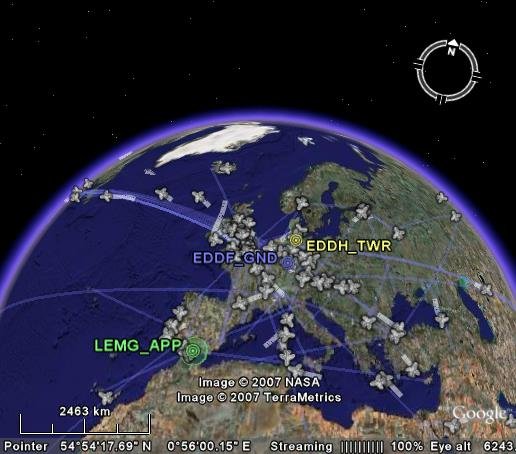
Now you can view all the aircraft and air traffic controllers currently connected to the VATSIM network using GoogleEarth!
- Each icon is clickable to display detailed flight or controller information.
- Each aircraft shows current position, and positions over the last twenty minutes all in three dimensions (ie: including altitude information).
- Great circle paths are plotted between aircraft origins and destinations.
- Data is updated every two minutes.
To view VATNZ for GoogleEarth, you need GoogleEarth v4 or greater.
(Available as a free download from http://earth.google.com/)
Once you have it installed, you're ready to view VATNZ for GoogleEarth.
Your feedback, comments, problems, etc welcome via:
- the VATNZ Website Forum;
- or email to the author, Nick Johnston.